Archive | Growth RSS feed for this section

The 2012 Draft Comprehensive Plan for Charles County: What You Get When the Developers Write Your Plan

Posted by:


4 Feb

Historically, land use decisions have been left up to local governments. While the State has tried to influence these decisions via various policy statements regarding smart growth, local autonomy has rarely been challenged and the laws implementing State policy generally have no “teeth.” Clearly, sprawl development has not been significantly curbed by these policies relying on voluntary compliance and recent legislation has reflected a trend to add at least the threat of a “stick” to the lure of a “carrot.”

SB236, The Sustainable Growth and Agricultural Preservation Act of 2012, encourages development supported by public sewer systems as opposed to sprawl development on septic systems. On the surface, this looked like a “win-win” piece of legislation that limits where septic systems can be used as a way to promote smart growth with a strong Chesapeake Bay cleanup component. The legislative provisions were implemented via “shall” statements to more forcefully push local government toward smart growth policies that concurrently reduce the associated growth costs born by the taxpayers and threats to the environment. However, some counties have revolted against the State’s threat to their autonomy and decided to test the State’s resolve to use the “stick.” Charles County seems poised to join the ranks of Frederick, Cecil and others who don’t have a problem with new development costs being born by the taxpayers and the water being too dirty for their children to play in.

Normally, there is some give and take between smart-growth advocates and the development community during the comprehensive land-use planning process. However, the 2012 Draft Comprehensive Plan for Charles County (The Plan) was essentially written by the development community to the exclusion of smart-growth policies, and without directives and goals based on serving the broader public’s interest. The process was permeated by the insistence of a majority of the Planning Commission (PC) that zoning density is a property right and downzoning is a “taking” of rights – a conclusion that is not supported by legal precedence, court decisions or the history and application of local zoning ordinances throughout this nation.

Therefore, any attempt to limit development anywhere in the County was automatically opposed with no regard for the obvious and well-documented potential environmental, quality-of-life, and fiscal consequences. Ultimately, this “takings” argument has set the course for a new land-use vision that will burden taxpayers with the cost of sprawl, cause further environmental degradation, and destroy resources that have public-health, ecological and economic value.

This Property-rights hysteria has led to clear violations of State policy as implemented in Maryland statutes. The development forces took complete control of the process via their sympathizers on the PC who willingly ignored and even actively conspired to circumvent State laws. The PC majority blindly embraced a tiers map developed in secret by a pro-development lobby made up of realtors, developers and farmers/speculators. Instead of complying with either the spirit or letter of SB236, the developer map ignored clear policy goals and statute text aimed at limiting septics in sensitive areas. In an attempt to circumvent the text of the Bill, the PC voted to change the zoning of over half the County to remove the word “Conservation” from the zoning classifications. There was no planned comprehensive rezoning and no assertion of a mistake or change in neighborhood as required by the Land Use Article in State Statutes. The majority of the PC just “spot-zoned” all the areas where they wanted to increase development on septics in total disregard for the law.

Apparent loop holes in the text of the Bill were exploited to increase the size of all minor subdivisions on septics from five to seven lots and also allow residue parcels to be treated as new subdivisions so some existing minor subdivisions can be expanded to 12 lots. Adequate Public Facilities mitigation is much less of a burden for minor subdivisions than for major subdivisions. Therefore, minor subdivisions are more of a burden to the taxpayers but better for the builders’ bottom lines.

The apparent corruption of sound growth and development concepts has also infected the Board of County Commissioners (BOCC) who didn’t have to endorse the PC’s biased anti-environment agenda. However, recent actions by the BOCC indicate that the development lobby has succeeded in seizing control of at least three of the five Commissioners who are willing to rubber-stamp the irresponsible decisions of the rogue Planning Commission.

Given that the state has established that the public has a right to witness the iterative process of zoning and comprehensive planning, it is critical to note that the public was not privy to details surrounding how this tiers map was developed. It was created by a private company, under the direction of a pro-development faction, and the public did not have access to the decision-making regarding what parameters were used to devise and establish the four tiers.

It remains to be seen if the political will to protect, preserve or conserve anything exists at the BOCC level.  However, it seems clear that the laws have enough “teeth” to hold Charles County accountable for The Plan and the tiers map, under review by various agencies. That the laws have been violated is not debatable; the violations are obvious and only the capability and commitment to enforce them are in question. It seems likely that Charles County will join the ranks of other counties thumbing their noses at state policies and that enforcing these policies and the laws that are being broken will fall to either the State or to coalitions of private organizations with limited legal assets.

It also seems that this type of behavior on the part of the PC majority should qualify for disciplinary action against them. According to The Land Use Article, the BOCC has the authority to remove Planning Commissioners for malfeasance. Most oaths of office include promises to honor laws and uphold the public trust, neither of which has been done in this case. However, the BOCC has not taken such action and the political will to do the right thing may not be strong enough – especially since their majority seems to mirror the same contempt for state law and the majority of Charles County citizens as does the PC. However, it should not be assumed that the residents of Charles County are unwilling to seek judicial remedies against those officials who ignore our laws and abuse the public trust. The PC-approved tiers map and comprehensive plan both fail Charles County, its citizens, and the Chesapeake Bay.


Print Friendly

‘We Must Preserve an Economic Asset’

Posted by:


6 Mar

(This ninth installment in our series, What’s It Going to Take?, looks at how the environmental community can regain the initiative and build the political will necessary to clean up the Chesapeake Bay.)


Whats It Going to Take?

In this exclusive interview with the Bay Action Plan, Chesapeake Bay Program Director Nick DiPasquale says that the costs of cleaning the Chesapeake Bay are significant, but manageable.

“No time is a good time when you’re talking about trying to implement very costly pollution control measures,” DiPasquale said. “But when you spread that cost over the life of a project…you find that the cost to individual households is a few dollars a month. Compare it to cellphone or cable costs, it puts things into perspective.”
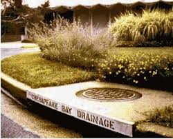
Watch the video:

Print Friendly

Sprawl Poisons the Bay

Posted by:


12 Sep

(Posted by Gerald Winegrad). The recent deluges leading to massive stormwater runoff into the Chesapeake Bay may cause great damage to an already seriously impaired system. We previously have discussed in this spot the huge flows of Bay-choking nutrients and sediment from farms each time it rains. Now, we will devote discussions to the pollution flowing from developed lands including huge amounts of nutrients, sediment, and toxic chemicals.

Bay Watershed Forest Cover, Chesapeake Bay Program

The Chesapeake’s watershed before 1607 was 95 percent forested with huge acreage of intact wetlands. These forests and wetlands absorbed and held nutrients and sediment. The flow of these Bay-killing pollutants was greatly accelerated due to enormous changes in land use when we converted forests and wetlands to agriculture and then, more recently, to development. The Bay region has since lost about 50 percent of its forest cover and 72 percent of its wetlands. No change has been more devastating for the Bay.

Our Senior Scientists and Policy Makers for the Bay group has concluded that we must change the way we do business as population in the Chesapeake’s watershed continues to grow&emdash;and continues to sprawl. The population more than doubled from 8.1 million in 1950 to 17 million today. There are 3.8 million more people since the Bay Program began in 1983. Demographers expect 3 million more by 2030.

We also consume more land per capita. The average household size decreased during the last 30 years, but the average lot size increased 60 percent. And we harden more land per capita. From 1990 to 2000, the population grew by 8 percent, while impervious surfaces–paving and roofs grew by a whopping 41 percent. At this rate, in ten years an area more than twice the size of Shenandoah National Park will no longer soak up rain, nutrients, and sediment because of impervious surfaces such as roads, shopping centers, houses, and parking lots.

Policies to channel growth into existing towns and cities and put an end to sprawling development aren’t working. Instead of growing where schools, transportation, and utilities exist, we are growing into forest and fields. In Maryland, the much-touted Smart Growth approach is an abject failure. Thirteen years after its enactment, this non-regulatory approach has had no discernible impact on curbing sprawling development, fostering better land use, or protecting open spaces. Even the Rural Legacy program under Smart Growth has not led to better protection of designated open space areas of fields and forests.

The State of Maryland’s own data details the failure: 78 percent of the land on which new homes were built from 1999-2008 was outside the Priority Funding Areas designated for growth. This compares to 75.6 percent from 1990-1998 before the law went into effect. More single family residential housing was developed outside Smart Growth areas than before the law was enacted. Further, the average amount of land used by each home built inside growth zones has crept upward.

The cost to the Bay states of this failure to rein in sprawl is daunting as such land-abusing development cripples the state financially, socially, and environmentally. Many urban areas, such as Baltimore City, continue to lose population. Of Maryland’s 157 municipalities, 40 lost population from 2000 to 2009 and 61 others had a population increase of less than 100 while the state’s population grew by 7.6 percent. While we close schools, fire houses, libraries, and churches in Baltimore City, we must pay to build similar facilities in surrounding counties.

This sprawl and spread of impervious surfaces is bad for the Bay. Stormwater runoff flushes pollutants to streams and changes their natural flow. It is the only source of water pollution that had been increasing until the economic slowdown. Existing stormwater management laws do not prevent this increasing pollution from development.

The dilemma is that while we have failed to address sprawl development and increasing stormwater flows from new development, existing developed areas present expensive challenges in that stormwater retrofits are generally very expensive. So, as we allow increases in stormwater pollution from new development, the Bay is already overwhelmed from existing runoff from farms and developed lands. The development juggernaut, coupled with the failure to systematically address existing impervious surface pollution, may undo all efforts to revive the Chesapeake.

So what can we do?
Our Senior Bay Group has made strong recommendations to solve the problem: Strong state land use controls can eliminate sprawl and stringent stormwater management requirements with impervious surface limits can eliminate any increases in pollutants from runoff from new development. We have recommended that state legislatures and local governments establish a no net loss of forest policy with protection and replanting of forested stream buffers a must. The loss of forests must be ended.

Requirements for and significant funding to clean up runoff from existing urban areas also is needed. Stormwater utilities must be established by all local governments. The states need to develop dedicated funding sources for stormwater retrofits and the establishment of an impervious surface fee on all impervious surfaces (like the Flush Fee) is the most logical source.

We have recommended that all new development have stringent stormwater runoff controls so as to achieve no net increase in pollutants or stormwater flows to the Bay with offsets possible. Scientists have documented even a 3 percent impervious surface cover in a watershed can cause damage to water quality.

All of those concerned with Bay restoration know that losing forests substantially increases the amount of pollutants reaching the Bay. A 2006 report found that from 1982–1997, development destroyed 140 acres of forest a day in the watershed, a total of 750,000 acres. This trend is pre-dicted to accelerate, producing catastrophic results for our rivers and the Bay. Net wetland acreage from a regulatory standpoint appears to have been stopped, but many wetlands still are filled for development and others are impaired by development activities.

However, state legislatures and local governments have not acted to establish a no net loss of forest policy with protection and replanting of forested stream buffers a must. This loss of fo-rests must be ended. Governor O’Malley’s 2007 transition team recommended that this no net loss of forest policy be established but this has not been done. The Chesapeake Bay Agreement called for 10,000 miles of riparian forest buffers by 2010. We’ve planted only a little more than half, and experts say that goal is too modest with at least 30,000 more miles needed to meet restoration goals. Controlling development will help achieve another vital goal – preserving forest land.

Unless we are prepared to accept a continuously declining Chesapeake Bay and the loss of our natural heritage, these difficult measures must be adopted — and soon.

Print Friendly

A Riverkeeper Reflects

Posted by:


6 Jun

(Posted by Jeanne McCann.)

Local photographer David Joyner interviews Riverkeeper Fred Tutman about his rural roots, growing up on a farm, how he came to be the Patuxent Riverkeeper and the specific pollution issues facing the Patuxent River and the Chesapeake Bay, and his life as an environmental activist.

Fred Tutman, Riverkeeper from david joyner on Vimeo.

Print Friendly

“Death by a Thousand Cuts”: Chesapeake Bay’s Disappearing Shoreline

Posted by:


3 Jun

(This is the first in a series of reviews of notable films that we feel should be part of any card-carrying environmental activist’s toolkit. We’ve chosen films that we think have made an important contribution to understanding the challenges facing restoration of the Chesapeake Bay. We kick off with a look back at Michael English’s 2008 gem, “Weary Shoreline.” -Eds.)

(Posted by John D. Wickham.)

Weary ShorelineCoastal Maryland, encompassing the state’s capital, Annapolis, the counties of Anne Arundel, Talbot, and Dorchester, and still other areas, is one of the most beautiful natural landscapes in the United States, whose rivers and tributaries feed into the nation’s largest estuary, the Chesapeake Bay. Though picturesque, this border area where land and sea meet has been under relentless pressure from human population growth and real estate development in the last three decades. Estimates put Southern Maryland’s loss of forest cover at more than 160,000 acres in the last fifteen years.

Despite the efforts of legislators, government officials, scientists, and environmental activists, Maryland’s coastal areas continue to face ongoing – and increasing – pressure from illegal and ecologically damaging real estate construction in so-called “critical” areas, which lie within 100 and 1,000 feet of the shore. As the excellent documentary “Weary Shoreline” (2008) makes clear, the failure of the well-intentioned 1984 Maryland Critical Area Law to limit shoreline development has resulted in declining water quality in rivers and the Chesapeake Bay, and has allowed escalating efforts to build in forested buffer areas along the water’s edge.

How has this come about? To understand, it helps if one starts by examining what the Critical Area Law intended. As “Weary Shoreline” explains, the aim of the law was threefold: 1) protect water quality; 2) conserve shoreline habitat; and 3) accommodate future growth. The law does not, according to the film, eliminate landowners’ rights to build, but instead offers guidance on how to do so without harming the environment. It seeks to accomplish this by preventing the cutting of trees and the clearing of brush within 1,000 feet of the shore. The law also prevents all construction within 100 feet of the shore, unless a variance is obtained.

What’s at stake? As scientists and activists in “Weary Shoreline” point out, preserving forest cover and preventing construction on soils near the shoreline helps stop sediments, oil, and other harmful pollutants from draining into rivers and tributaries that flow into the Chesapeake Bay. Soil sediment, for example, clouds river water, blocking light to underwater grasses, in turn retarding their growth. Without underwater grasses, crabs are deprived of critical habitat where their young can nurse and grow safely to adulthood. Soil sediment can also cover oysters, preventing the bivalves from taking in and filtering water, which in turn harms their health.

Scientists in the film highlight other environmental harms from expanding real estate development, including a decline in the overall diversity of animal life (e.g., birds and fish) near the shoreline. Indeed, according to Dennis Whigham of the Smithsonian Environmental Resource Center, a contributing author of the 2006 EPA study Integration of Ecological and Socioeconomic Indicators for Estuaries and Watersheds of the Atlantic Slope (PDF), the relationship between increasing real estate development and declining wildlife diversity in coastal Maryland “jumped out at us.” Whigham concluded that “scientifically, the message is fairly clear.”

Why has the Critical Area Law been unable to prevent growing environmental harm? Anne Merwin, an attorney serving in a law clinic at the University of Maryland in 2008, set out to answer just this question, studying three years of records under the measure. She learned that the law itself does not provide for state-level enforcement of violations to its provisions. Instead, it places enforcement authority in the hands of local jurisdictions, which, Merwin found, lack financial resources and manpower as well as the political will to implement the law. A classic trade-off arises at the local level, Merwin explains, between the public’s interest in clean water, on one hand, and individual landowners’ rights, on the other. Such opposing interests are inevitable, but are made more difficult under the Critical Area Law, Merwin points out, since it grandfathers structures built prior to 1984, exempting them from the act’s restrictions on how construction should occur. As a result, when current landowners identify shoreline to build on, they see pre-existing structures within the 100- and 1,000-foot zones, and feel entitled to build within the same area.

Fred Tutman, the Patuxent Riverkeeper, who also appears in the film, believes that the town of Benedict in Charles County offers a case study of what is occurring. Benedict used to be known as a seafood capital, but now, according to Tutman, would be better described as a “real estate capital” and a recreational boating area. Tutman points out that crab harvests near the town are at an historic low, and that neither crabs nor oysters can find enough oxygen in the silted, muddied water.

The film explains that the Critical Area Law was supposed to provide guidance to local governments, but that the monetary gains that new housing and construction provide in the form of new taxes, higher county revenues, and local jobs usually prove too great to resist. Moreover, it is precisely in the local jurisdictions, at the water’s edge, where development pressure is greatest.

Anne Arundel County, for instance, is home to the state capital, Annapolis, which in turn is just a one-hour drive from Baltimore or Washington, D.C. In addition, there are 530 miles of tidal shoreline in the county, giving it more critical area than most counties in Maryland. In 2007, more than 1,100 new building sites were established in Anne Arundel, with an estimated value of $192,000,000 in construction costs. What’s more, the value of waterfront properties there continues to rise, as much as five-fold in some cases in the last twenty years.

Overall, “Weary Shoreline” is an excellent introduction to an urgent problem with many facets. Though one might at times wish for a slightly clearer explanation of the natural processes at work in the Bay (e.g., distinction between shoreline development, which deposits soil sediment and stormwater runoff, and agricultural and poultry operations, which introduce nitrogen and phosphorous), as well as more background on the legal battles surrounding property rights, development restrictions, and “regulatory takings” (whereby local governments are required to compensate landowners when they prevent them from developing their properties), these are small shortcomings. What one gains, in abundance, is a quick overview of the problem (including beautiful aerial shots of the Chesapeake Bay), as well as numerous direct interviews with stakeholders on all sides of the problem, thus ensuring a balanced and fair treatment of a complicated collective dilemma.

The film would be excellent for use in upper-level high school classes, undergraduate classes in environmental science or policy, and graduate and law school classes in regional planning and environmental law and policy. Such broad dissemination in schools, in fact, might give Maryland and its citizens a better chance of anticipating and responding to future growth challenges.

Paul Spadero, President of the Magothy River Association, who advocates for greater limits on shoreline development throughout the film, is the one who describes the Chesapeake Bay shoreline as having grown “weary” from thousands of cuts. In response, he urges that a new ethic be adopted, one that doesn’t treat fragile shoreline property as an “inexhaustible commodity.” Given that experts have estimated that as many as one million new residents will move into the area in the next twenty years, this sounds like an idea worth listening to.

Click here to buy a copy of “Weary Shoreline” from Maryland Public Television.

Weary Shoreline (©2008)
Produced by Robin Lloyd
Directed by Michael English
Funded by The Keith Campbell Foundation
Aired on Maryland Public Television (MPT)

Print Friendly